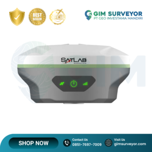
The SatLab Eyr GNSS Receiver is an advanced high-precision GNSS RTK receiver designed to support modern surveying and geospatial data collection. This receiver introduces innovative dual-camera visual positioning technology, allowing surveyors to perform image-based measurement and AR visual stakeout for more intuitive and efficient field operations.
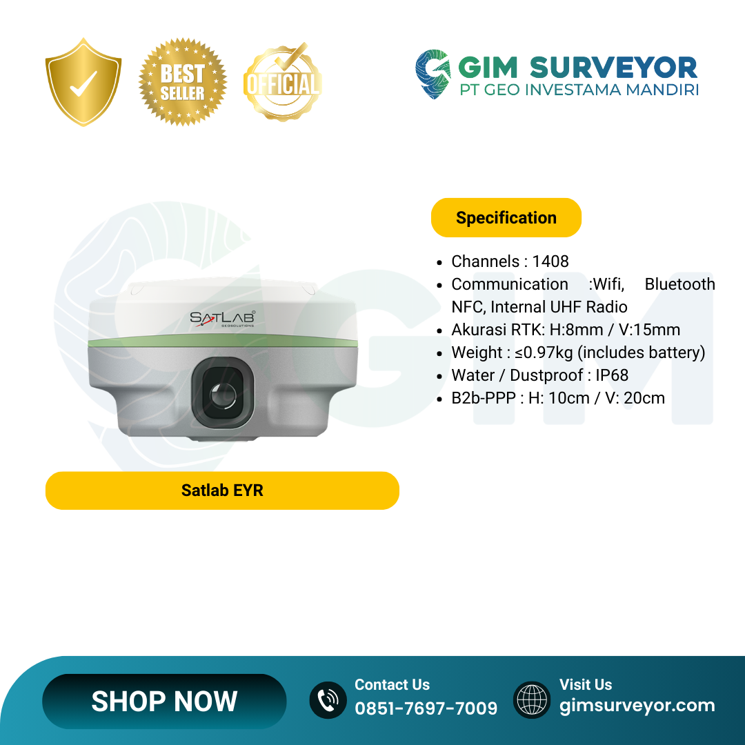
Equipped with a powerful GNSS chipset and multi-constellation satellite tracking capability, the Eyr delivers stable centimeter-level positioning accuracy even in challenging environments. The receiver supports up to 1408–1760 GNSS channels, ensuring strong signal tracking and improved resistance to interference.
The integrated HD dual cameras allow contact-free measurement and visual stakeout directly in the field. The rear 5 MP camera enables real-time coordinate capture at distances between 2–15 meters with an accuracy of approximately 2–4 cm, while the bottom camera supports AR-based live-view stakeout with around 2 cm accuracy, making stakeout faster and easier.
The receiver is also equipped with an upgraded IMU tilt compensation system, enabling accurate measurements even when the survey pole is tilted. With its compact and lightweight design, built-in radio communication, and long battery life, the Eyr GNSS receiver provides an efficient and reliable solution for professional surveying tasks.
The Eyr GNSS receiver is suitable for a wide range of applications including:
-
Land and cadastral surveying
-
Construction layout and engineering surveys
-
GIS data collection
-
UAV ground control point (GCP) surveys
-
Hydrographic surveys
-
3D modeling and photogrammetry
Technical Specifications
GNSS Tracking
-
Satellite systems: GPS, GLONASS, Galileo, BeiDou, QZSS, IRNSS, SBAS
-
Frequencies: L1, L2, L5
-
GNSS channels: 1408 / 1760 channels
-
Multi-constellation tracking support
Positioning Performance
Static Survey
-
Horizontal: 2.5 mm + 0.1 ppm RMS
-
Vertical: 3.5 mm + 0.4 ppm RMS
Fast Static
-
Horizontal: 2.5 mm + 0.5 ppm RMS
-
Vertical: 5 mm + 0.5 ppm RMS
RTK Positioning
-
Horizontal: 8 mm + 1 ppm RMS
-
Vertical: 15 mm + 1 ppm RMS
Code Differential GNSS
-
Horizontal: 0.25 m + 1 ppm RMS
-
Vertical: 0.5 m + 1 ppm RMS
Visual Measurement & IMU
-
HD dual cameras for image measurement and visual stakeout
-
Rear camera: 5 MP for image survey (2–15 m range)
-
Bottom camera: 2 MP for AR live-view stakeout
-
Image survey accuracy: 2–4 cm
-
Visual stakeout accuracy: 2 cm
-
IMU tilt survey accuracy: 8 mm + 0.7 mm/° tilt
Communication
-
Built-in UHF radio (multi-protocol)
-
Radio working range: up to 7 km (typical open area)
-
Bluetooth
-
Wi-Fi
-
Cellular LTE modem
-
RTK network support (NTRIP)
Hardware
-
Dimensions: Φ130 mm × 79 mm
-
Weight: ≤ 0.97 kg
-
Internal storage: 8 GB ROM
Battery
-
Internal battery: 7.2 V / 6900 mAh
-
Operating time: >12 hours in rover mode
-
Charging: 5 V DC
Environmental
-
Protection rating: IP68 (waterproof & dustproof)
-
Rugged design for harsh field environments
✅ Key Advantages
-
Dual-camera AR visual stakeout technology
-
Contact-free image measurement capability
-
1408–1760 GNSS channels for strong signal tracking
-
High-precision RTK centimeter-level accuracy
-
IMU tilt compensation for faster field surveys
-
Lightweight and durable IP68 design